Uncategorised
- Details
- Written by Super User
- Category: Uncategorised
- Hits: 13495
For inquiries regarding QPS, contact us on the followings:
Email: This email address is being protected from spambots. You need JavaScript enabled to view it.
Tel: +971-54-498 9295

- Details
- Written by Super User
- Category: Uncategorised
- Hits: 1885
- QPS Software Links
- Qinsy 9
- Qimera 2
- Fledermaus 8
- Qarto 3
- Qastor 2
- Major Equipment Data Sheet
- Surface Positioning
- C-Nav
- Hemisphere
- Gyro
- Underwater Positioning
- USBL
- LBL
- Underwater Gyro
- Echoscope
- Blue View
- Underwater Sensors
- Sound Velocity Profiler
- Intelligent Pressure Sensor
- Sound Velocity Sensor
- Geophysical and Bathymetric
- Single Beam Echo-Sounder
- Multi Beam Echo-Sounder
- Side Scan Sonar
- Sub Bottom Profiler
- ROV
- Surface Positioning
Camera
Sonar
Thruster
Pan& Tilt
Gemini
Dual Head Profiler
Multicomm Junction Box
Altimeter and Bathy
Intelligent Gyro Compass
Boom Camera
Pipe/ Cable Tracker
- Details
- Written by Super User
- Category: Uncategorised
- Hits: 3821
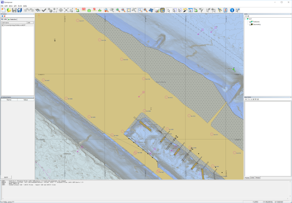
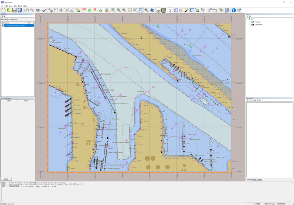
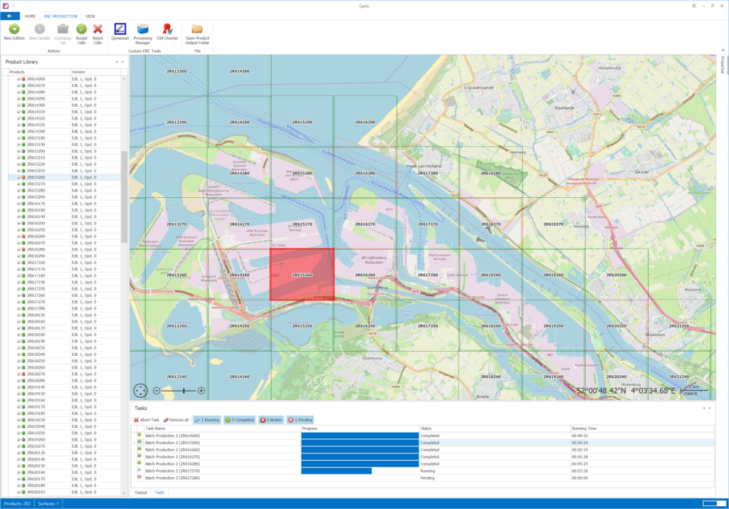
![]() Qarto is ENC production software. Built for rapid and automated product turnaround, Qarto is the tool of choice for some of the largest ports in the world, ensuring timely products and safe operation on those busy waterways within them.
Qarto is ENC production software. Built for rapid and automated product turnaround, Qarto is the tool of choice for some of the largest ports in the world, ensuring timely products and safe operation on those busy waterways within them.
The strength of Qarto is very fast and automated ENC production. Qarto makes possible the short turn-around times from survey to chart that are necessary for the safe operation of busy waterways.
- Details
- Written by Super User
- Category: Uncategorised
- Hits: 3614
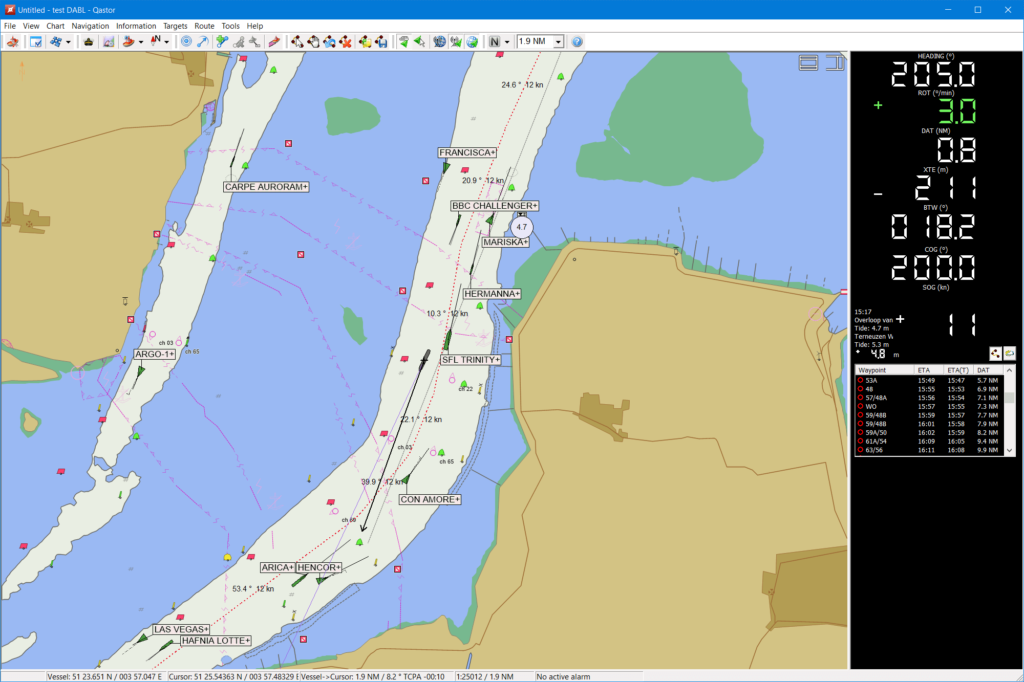
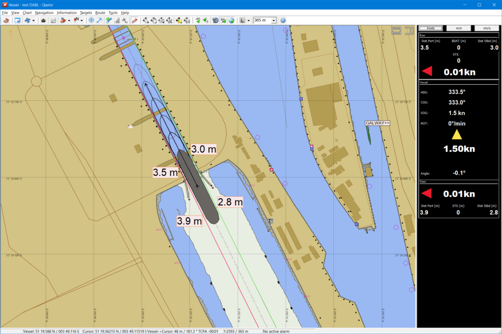
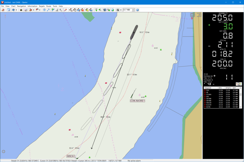
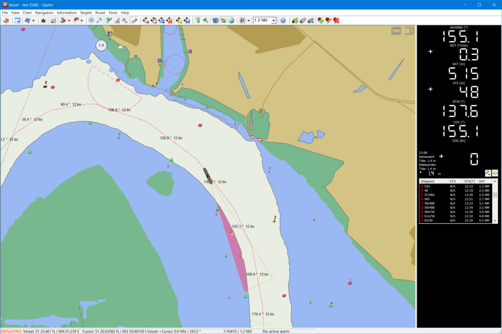
 Qastor (Precise piloting)
Qastor is a precise navigation, piloting and docking software application capable of receiving real-time meteorological information and chart updates via the Connect Server.
A precise navigation software for piloting and docking, and with Under Keel Clearance capability and modes customized to specific, critical operations, Qastor also supports high-resolution overlays to expand navigable water, and real-time meteorological updates via the Connect Server, resulting in optimal situational awareness for pilots.
- Details
- Written by Super User
- Category: Uncategorised
- Hits: 3739
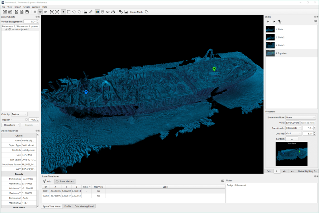
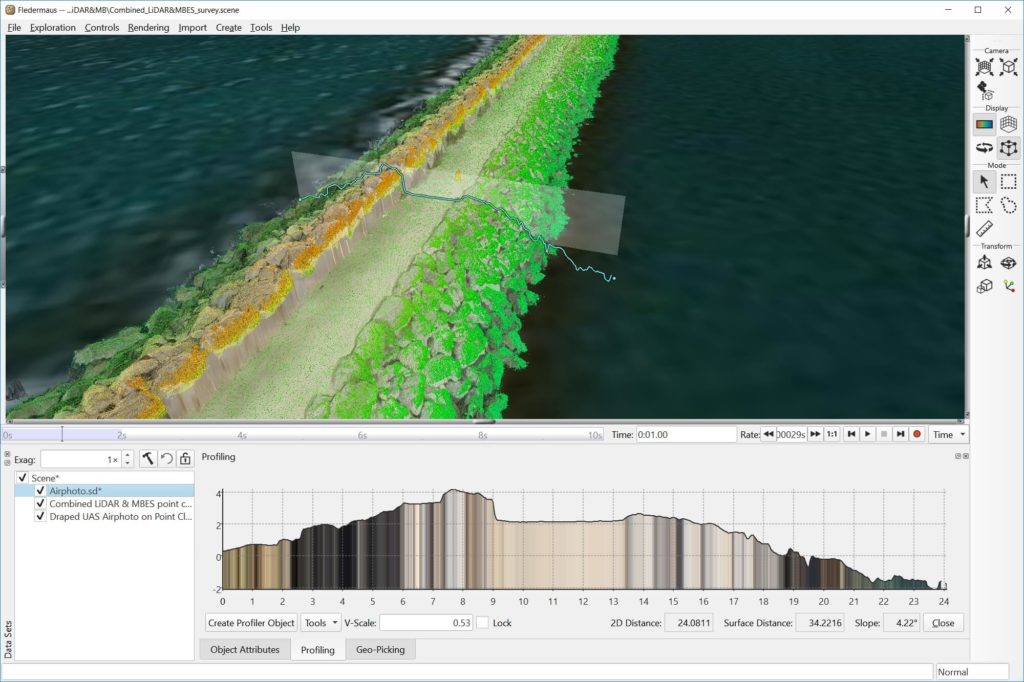
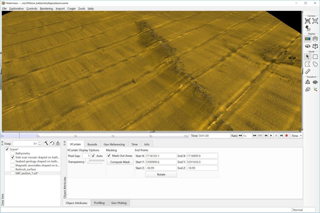
![]() Fledermaus (4D geo-spatial analysis)
Fledermaus (4D geo-spatial analysis)
Fledermaus unlocks the potential of your data, with a wide variety of analysis tools working in 3D or 4D space. With fast and easy presentation tools, show your data better than ever before.
Fledermaus supports a very wide variety of data types for direct import, where realizations and connections are made among data types in 3D and even 4D space. The extensive functionality of Fledermaus allows its use across many phases of a project from the planning, processing and QC, through to analysis and production of images, plots, and videos.

- You are here:
-
Home

- Uncategorised